Colombia’s adventure capital is also a proper town: a square with a cathedral, an island park hung with moss, two rivers and a bus station that will take you anywhere in Santander. Here is how we would spend it.
SamS sits at Carrera 10 #12-33, right beside Parque La Libertad — San Gil's main square, which locals also just call the parque principal. It is the town's meeting point: old ceiba trees throwing shade, a lit fountain, a winged statue of Cacique Guanentá, and the town hall and cathedral on its edges. Grab a coffee, sit on a bench and watch San Gil go about its day.
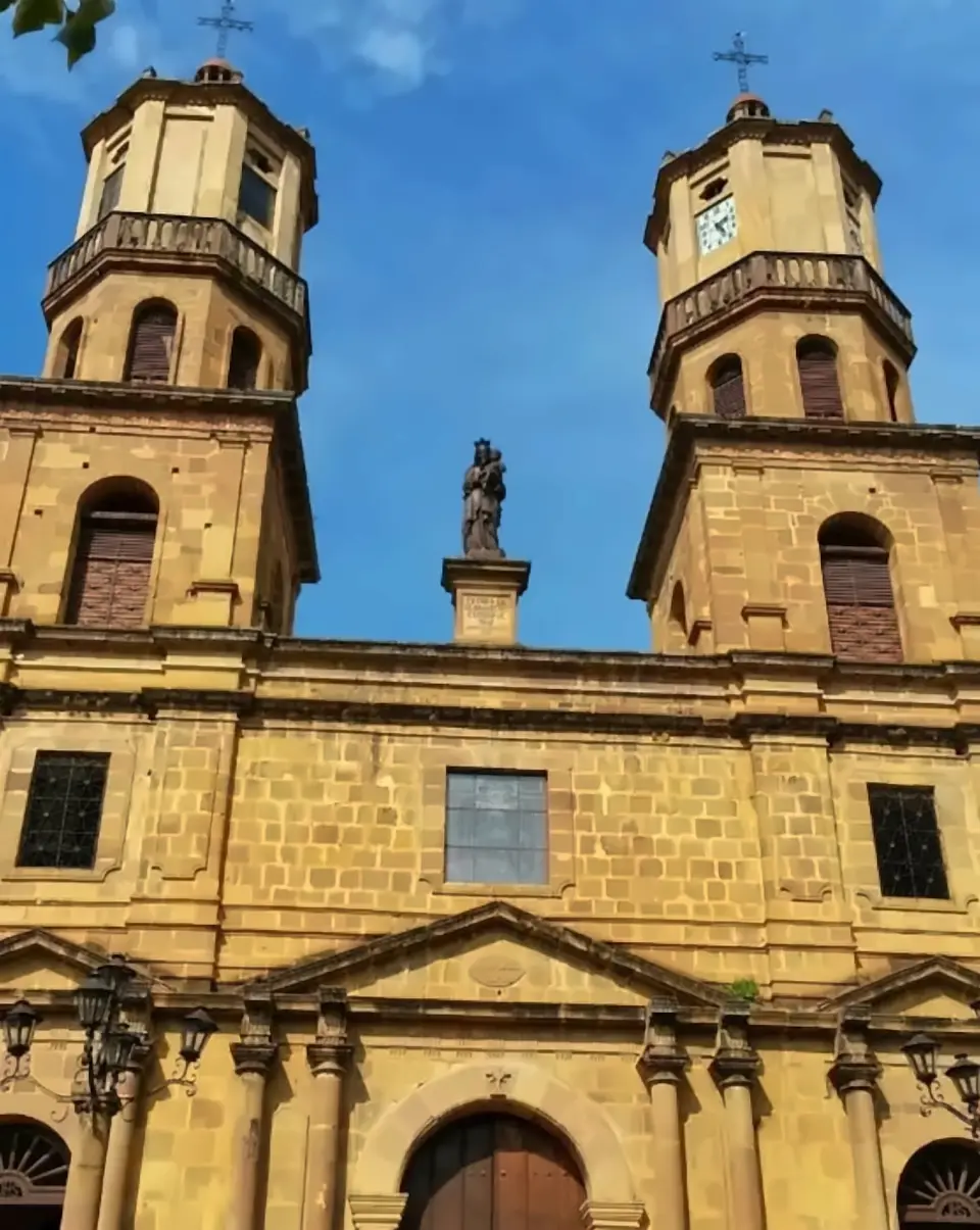
On the north-west corner stands the Catedral de la Santa Cruz, seat of the Diocese of Socorro y San Gil. Construction began in 1769 and the main church was finished about thirty years later; the towers you see today went up in the early twentieth century, and it was consecrated in June 1935. It glows at night — have a look on your way back from dinner.
Around the square, the historic centre climbs in steep stone streets laid out from the seventeenth century down towards the Río Fonce, and it is a declared National Monument. Walk downhill and you reach the river, the Malecón and the moss-hung trees of El Gallineral.
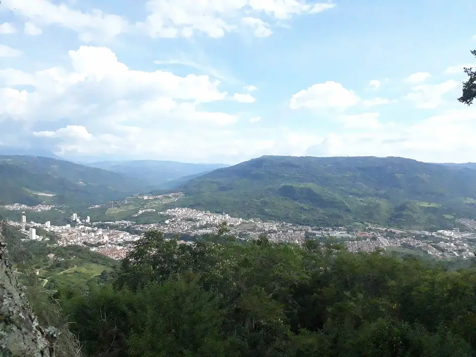
San Gil sits in a warm valley: the town hall puts the average temperature around 24 °C, with highs near 32 °C down by the big rivers and lows around 15 °C. Rain falls mostly in April–May and September–October. The Río Fonce runs straight through town, and that river shapes most days here, whether you're rafting it or just sitting beside it.
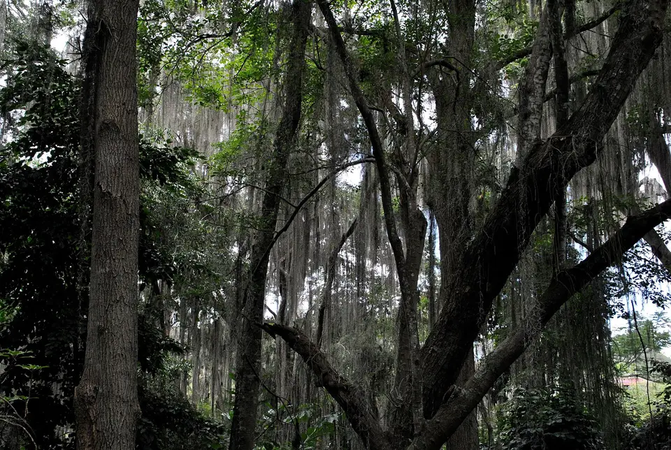
Start with El Gallineral, a four-hectare island where the Quebrada Curití splits before meeting the Fonce. Its trees wear long grey beards of Spanish moss — barbas de viejo — over stone paths and little bridges. When you want water you can sit in, Pozo Azul is about 2 km out of town, and Pescaderito, near Curití, is a chain of natural pools and rock slides.
Further out, the forest gets wilder. Juan Curí, in rural Páramo, is a tall multi-tier waterfall you can walk to, swim under or rappel down. All of these are easy to reach from the Terminalito, the small local bus station a few blocks from the square.
Average temperature
About 24 °C (lows ~15 °C, highs ~32 °C by the rivers)
Colombia's official tourism site calls San Gil the capital of extreme sports, and the town earned it. Commercial rafting started here in 1996, and in 2004 the Santander government named San Gil the department's Capital Turística. Today the same valley offers rafting, tubing, caving, waterfall rappelling, bungee and paragliding, most of it within an hour of the square.
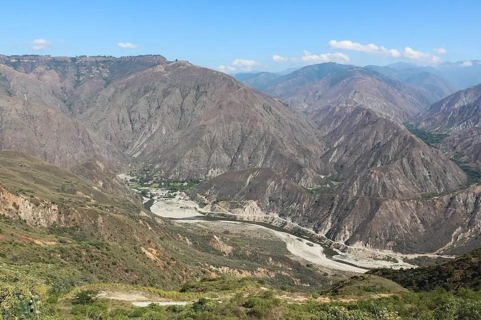
Water comes first. The Fonce, right in town, is the friendly class II–III run; the Suárez, about an hour away, is class IV–V and only goes when the river level allows. Up in the air, tandem paragliders launch from Dos Ventanas high on the Chicamocha Canyon — a canyon so deep that the operators flying it talk about a 1,200-metre drop to the river.
Underground, Cueva del Indio and Cueva de la Vaca trade sunlight for mud, bats and dark water. Every activity is run by local operators, each with its own rules on age, weight and weather — so read the details, then ask us what fits your days.
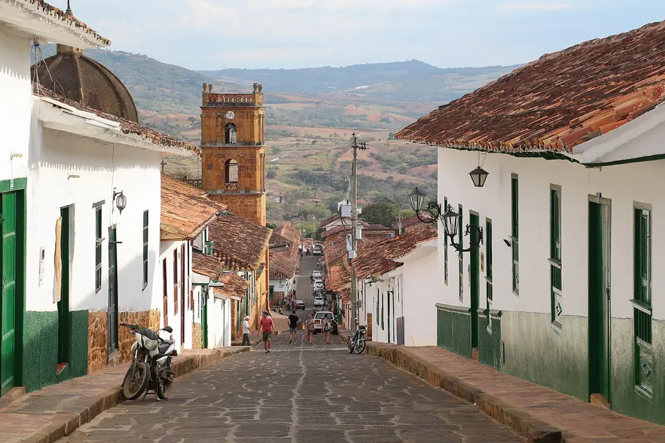
Barichara, 21 km away, is one of Colombia's 17 official heritage towns: whitewashed walls, terracotta roofs and stone streets so steep they come with views. From the top of town the Camino Real, an old stone road declared a National Monument in 1977, drops about 5.5 km to Guane. At a good pace it takes two to two and a half hours.
Guane itself is tiny, with a small archaeological and paleontological museum. Closer to San Gil, Curití is about 15 minutes away — home to Cueva de la Vaca and the Pescaderito pools.
Head north on the road to Bucaramanga and you reach the Parque Nacional del Chicamocha, Panachi, 39 km from San Gil, where a 6.3 km cable car crosses the canyon to Mesa de los Santos. Pair it with a morning paragliding flight from Dos Ventanas, just a few kilometres away.
By bus from Bogotá (327 km): the official tourism site says about six hours by car; bus listings run from roughly 6 to over 8 hours depending on the service and traffic. From Bucaramanga (96 km): usually 2.5–3 hours, and one local operator warns it can stretch to 4 in high season.
From Medellín we found no direct bus; travellers change in Bucaramanga, and older guides put the whole trip at roughly 9–11 hours. Ask us if you need a current route.
By air, the nearest major airport is Palonegro in Bucaramanga, about three hours by road. San Gil's own Los Pozos airport has had SATENA flights — the airline currently lists Medellín (Olaya Herrera)–San Gil on Mondays, Wednesdays and Fridays — but the official tourism site still says there is no operational airport nearby. Check SATENA's schedule before planning around it.
Long-distance buses arrive at the main terminal, about 2 km from the centre at km 2 on the road to Socorro. It runs 24 hours. A short taxi gets you to the square; ask us for the current fare.
Day trips by local bus
Buses to the nearby towns leave from the Terminalito, Cotrasangil's small station a few blocks from the main square (Carrera 10 with Calle 17). Don't confuse it with the big terminal for long-distance buses.
From the Terminalito: Barichara (about 45 minutes, every 20–30 minutes in 2023 data), Curití (about 15 minutes; Cueva de la Vaca and Pescaderito), Páramo (Cueva del Indio, Juan Curí area) and Charalá or Ocamonte (ask to get off at the Juan Curí falls, about 40 minutes).
Timetables change and some sources are a few years old, so check the day before. Operators also offer transport for some activities — ask what your booking includes.
What to pack for San Gil
Shoes are the big one. Paragliding operators insist on closed shoes; rafting operators want strapped sandals or trainers — no flip-flops. For caves, bring closed, non-slip shoes you don't mind ruining.
Pack quick-dry clothes, a full dry change for every water day, a towel, sunscreen and insect repellent. A light jacket helps on paragliding flights. For the caves, wear clothes you never want back — you will come out muddy.
The town hall describes an average around 24 °C, with wetter spells in April–May and September–October, so a light rain layer earns its space in those months. On the Camino Real and other walks, carry plenty of water and avoid the midday heat.
Getting around the centre
SamS is at Carrera 10 #12-33, beside Parque La Libertad, San Gil's main square. Look for the BBVA ATM next to the entrance. The Catedral de la Santa Cruz is about a block away.
Most things in the centre are walkable. Our Booking.com listing puts El Gallineral and the Malecón about six blocks away, and the Terminalito for local buses is along Carrera 10 at Calle 17. The streets are steep in places — you'll feel it after a rafting day.
For the main bus terminal, about 2 km out, a taxi is the easy option. Ask at reception for current fares and the best walking routes.
Booking activities: what to ask
SamS's listing says you can book adventure activities with the hostel, and guests report doing it at reception. The activities themselves are run by local operators, so a few questions up front save surprises.
Ask: which operator runs it, and which river section or launch site; what time you leave and how you get there; what is included (transport, photos, food); the current age, weight and health rules; and what happens if the river or the weather says no.
Weather and water levels really do decide here. Suárez rafting is called on the day by river level, and canyon paragliding only flies in the morning when conditions allow. Build a spare half-day into your plans and nothing gets ruined.
Which one is which?
Fonce or Suárez? The Fonce runs through town at class II–III, with about 1–1.5 hours on the water; operators commonly accept ages 7+. The Suárez is class IV–V, about an hour away, takes most of a day and operators commonly state 18+.
Canyon or Curití paragliding? Chicamocha flights launch from Dos Ventanas in the morning and last 20–30 minutes, per the operator. Curití is a lower afternoon site with 12–15 minute flights — and the operator is clear it's not the canyon.
Cueva del Indio or Cueva de la Vaca? Indio: walk in, swim out, bats, and an optional jump into a dark pool. Vaca: wet all the way, crawling and a short underwater passage — skip it if tight spaces bother you.
Bungee 70 m or 140 m? The 70 m tower over the Fonce is close to town and offers tandem jumps; the 140 m basket at Peñón Guane is the bigger fall, solo only, per the reseller.